 vesseltracker.com
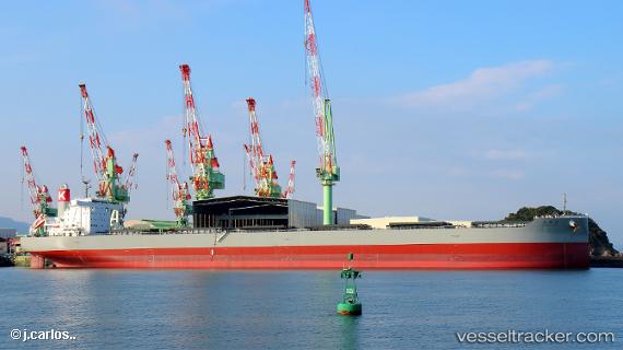
Vessel Shonai Maru IMO: 9827231, MMSI: 431043000 Bulk Carrier
UTC, 27.17072, 144.85027, course: 166, speed: 11
UTC, 26.76817, 144.96861, course: 164, speed: 11
2026-01-31 13:47:51 UTC, 26.40206, 145.08302, course: 165, speed: 10.7
Live AIS position:
UTC. 161 nm E of Omura),
updated 2026-01-31 13:47:51 UTC.
Find the position of the vessel Shonai Maru on the map. The latter are known coordinates and path.
marine traffic ship tracker show on live map
The current position of vessel Shonai Maru is 26.40206 lat / 145.08302 lng. Updated: 2026-01-31 13:47:51 UTCDetails:
Last coordinates of the vessel:
UTC, 27.42443, 144.76633, course: 167, speed: 10.5UTC, 27.17072, 144.85027, course: 166, speed: 11
UTC, 26.76817, 144.96861, course: 164, speed: 11
2026-01-31 13:47:51 UTC, 26.40206, 145.08302, course: 165, speed: 10.7