 vesseltracker.com
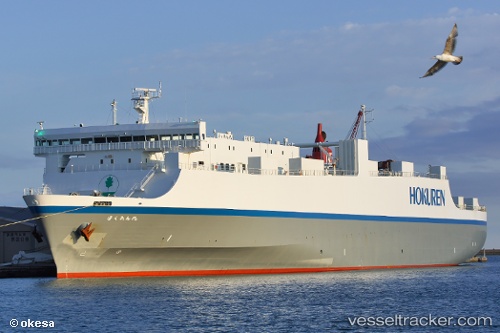
Vessel Houou Maru IMO: 9367786, MMSI: 431101139 Vehicles Carrier
UTC, 33.25370, 131.73483, course: 180, speed: 0
UTC, 33.28785, 131.78653, course: 72, speed: 19.7
2026-02-14 13:59:02 UTC, 32.94364, 132.26155, course: 150, speed: 20
Live AIS position:
UTC. 18 nm E of SAEKI),
updated 2026-02-14 13:59:02 UTC.
Find the position of the vessel Houou Maru on the map. The latter are known coordinates and path.
marine traffic ship tracker show on live map
The current position of vessel Houou Maru is 32.94364 lat / 132.26155 lng. Updated: 2026-02-14 13:59:02 UTCCurrently sailing under the flag of Japan
Details:
Last coordinates of the vessel:
UTC, 33.25974, 131.73637, course: 184, speed: 5.8UTC, 33.25370, 131.73483, course: 180, speed: 0
UTC, 33.28785, 131.78653, course: 72, speed: 19.7
2026-02-14 13:59:02 UTC, 32.94364, 132.26155, course: 150, speed: 20