 vesseltracker.com
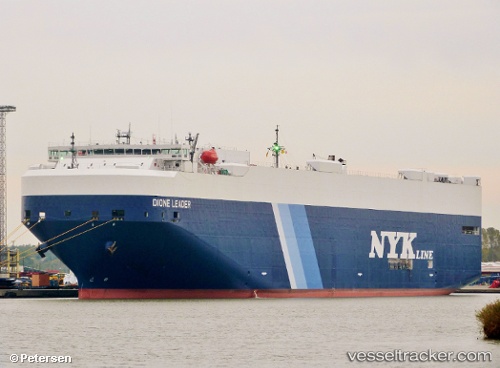
Vessel DIONE LEADER IMO: 9561954, MMSI: 431172000 Vehicles Carrier
UTC, -9.89833, 105.96000, course: -1, speed: 16
UTC, -9.19621, 105.72746, course: 338, speed: 16.5
2026-02-27 11:39:16 UTC, -8.82667, 105.60167, course: -1, speed: 17
Live AIS position:
UTC. 96 nm N of Flying Fish Cove),
updated 2026-02-27 11:39:16 UTC.
Find the position of the vessel DIONE LEADER on the map. The latter are known coordinates and path.
marine traffic ship tracker show on live map
The current position of vessel DIONE LEADER is -8.82667 lat / 105.60167 lng. Updated: 2026-02-27 11:39:16 UTCCurrently sailing under the flag of Japan
Details:
Last coordinates of the vessel:
UTC, -10.47833, 106.15500, course: -1, speed: 17UTC, -9.89833, 105.96000, course: -1, speed: 16
UTC, -9.19621, 105.72746, course: 338, speed: 16.5
2026-02-27 11:39:16 UTC, -8.82667, 105.60167, course: -1, speed: 17