 vesseltracker.com
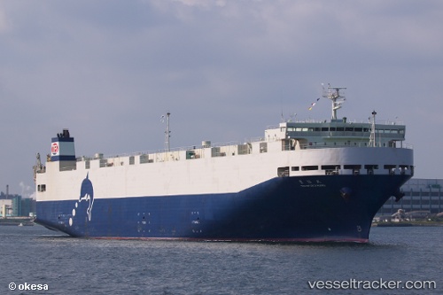
Vessel Toyofukumaru IMO: 9336921, MMSI: 431200688 Vehicles Carrier
UTC, 35.05773, 136.87833, course: 17, speed: 0
UTC, 35.05775, 136.87833, course: 18, speed: 0
2026-01-30 09:38:07 UTC, 34.74025, 136.77907, course: 155, speed: 20.6
Live AIS position:
UTC. Near Mihama),
updated 2026-01-30 09:38:07 UTC.
Find the position of the vessel Toyofukumaru on the map. The latter are known coordinates and path.
marine traffic ship tracker show on live map
The current position of vessel Toyofukumaru is 34.74025 lat / 136.77907 lng. Updated: 2026-01-30 09:38:07 UTCDetails:
Last coordinates of the vessel:
UTC, 34.81643, 136.76746, course: 0, speed: 12.4UTC, 35.05773, 136.87833, course: 17, speed: 0
UTC, 35.05775, 136.87833, course: 18, speed: 0
2026-01-30 09:38:07 UTC, 34.74025, 136.77907, course: 155, speed: 20.6