 vesseltracker.com
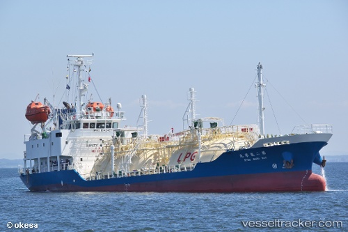
Vessel Ryueimaru No.2 IMO: 9771937, MMSI: 431222000 Lpg Tanker
UTC, 33.41874, 135.67018, course: 114, speed: 12.8
UTC, 33.62164, 136.20660, course: 46, speed: 11.8
2026-02-02 16:26:40 UTC, 33.92833, 136.63499, course: -1, speed: 12
Live AIS position:
UTC. 23 nm S of HAMAJIMA),
updated 2026-02-02 16:26:40 UTC.
Find the position of the vessel Ryueimaru No.2 on the map. The latter are known coordinates and path.
marine traffic ship tracker show on live map
The current position of vessel Ryueimaru No.2 is 33.92833 lat / 136.63499 lng. Updated: 2026-02-02 16:26:40 UTCCurrently sailing under the flag of Japan
Details:
Last coordinates of the vessel:
UTC, 33.60833, 135.30499, course: -1, speed: 10UTC, 33.41874, 135.67018, course: 114, speed: 12.8
UTC, 33.62164, 136.20660, course: 46, speed: 11.8
2026-02-02 16:26:40 UTC, 33.92833, 136.63499, course: -1, speed: 12