 vesseltracker.com
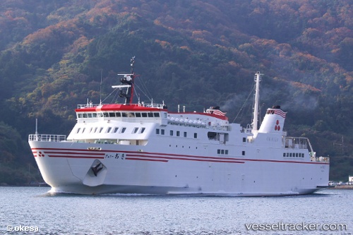
Vessel Ferry Oki IMO: 9284178, MMSI: 431401975 Passenger Ro Ro Cargo Ship
UTC, 36.14653, 133.17519, course: 91, speed: 17.6
UTC, 36.20322, 133.33597, course: 31, speed: 0.8
2026-02-05 07:25:40 UTC, 35.74373, 133.27837, course: 195, speed: 16.7
Live AIS position:
UTC. 10 nm N of SHICHIRUI),
updated 2026-02-05 07:25:40 UTC.
Find the position of the vessel Ferry Oki on the map. The latter are known coordinates and path.
marine traffic ship tracker show on live map
The current position of vessel Ferry Oki is 35.74373 lat / 133.27837 lng. Updated: 2026-02-05 07:25:40 UTCDetails:
Last coordinates of the vessel:
UTC, 36.18712, 133.34303, course: 160, speed: 16.1UTC, 36.14653, 133.17519, course: 91, speed: 17.6
UTC, 36.20322, 133.33597, course: 31, speed: 0.8
2026-02-05 07:25:40 UTC, 35.74373, 133.27837, course: 195, speed: 16.7