 vesseltracker.com
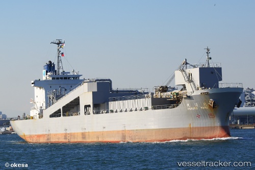
Vessel Hokuyo Maru IMO: 9185475, MMSI: 431501083 Limestone Carrier
UTC, 35.58385, 139.88298, course: 349, speed: 0
UTC, 35.58407, 139.88362, course: 316, speed: 0
2026-02-09 21:32:40 UTC, 35.58406, 139.88368, course: 317, speed: 0
Live AIS position:
UTC. Near Urayasu),
updated 2026-02-09 21:32:40 UTC.
Find the position of the vessel Hokuyo Maru on the map. The latter are known coordinates and path.
marine traffic ship tracker show on live map
The current position of vessel Hokuyo Maru is 35.58406 lat / 139.88368 lng. Updated: 2026-02-09 21:32:40 UTCCurrently sailing under the flag of Japan
Hokuyo Maru built in 1998 year
Deadweight:
10750 tDetails:
Last coordinates of the vessel:
UTC, 35.58384, 139.88307, course: 345, speed: 0UTC, 35.58385, 139.88298, course: 349, speed: 0
UTC, 35.58407, 139.88362, course: 316, speed: 0
2026-02-09 21:32:40 UTC, 35.58406, 139.88368, course: 317, speed: 0