 vesseltracker.com
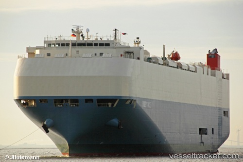
Vessel RUBY ACE IMO: 9476757, MMSI: 431881000 Vehicles Carrier
UTC, -27.37946, 153.16492, course: 38, speed: 0
UTC, -27.21359, 153.27802, course: 20, speed: 14.9
2026-02-26 12:02:04 UTC, -26.79991, 153.17725, course: 359, speed: 13.7
Live AIS position:
UTC. Near Kawana),
updated 2026-02-26 12:02:04 UTC.
Find the position of the vessel RUBY ACE on the map. The latter are known coordinates and path.
marine traffic ship tracker show on live map
The current position of vessel RUBY ACE is -26.79991 lat / 153.17725 lng. Updated: 2026-02-26 12:02:04 UTCCurrently sailing under the flag of Japan
Details:
Last coordinates of the vessel:
UTC, -27.37833, 153.16333, course: -1, speed: 0UTC, -27.37946, 153.16492, course: 38, speed: 0
UTC, -27.21359, 153.27802, course: 20, speed: 14.9
2026-02-26 12:02:04 UTC, -26.79991, 153.17725, course: 359, speed: 13.7