 vesseltracker.com
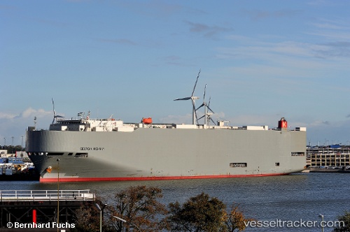
Vessel Georgia Highway IMO: 9339820, MMSI: 432629000 Vehicles Carrier
UTC, 35.05058, 136.83838, course: 341, speed: 0
UTC, 35.05055, 136.83838, course: 341, speed: 0
2026-02-28 02:08:54 UTC, 35.05060, 136.83839, course: 341, speed: 0
Live AIS position:
UTC. Near Nagoya),
updated 2026-02-28 02:08:54 UTC.
Find the position of the vessel Georgia Highway on the map. The latter are known coordinates and path.
marine traffic ship tracker show on live map
The current position of vessel Georgia Highway is 35.05060 lat / 136.83839 lng. Updated: 2026-02-28 02:08:54 UTCDetails:
Last coordinates of the vessel:
UTC, 34.90652, 136.73511, course: 44, speed: 2.9UTC, 35.05058, 136.83838, course: 341, speed: 0
UTC, 35.05055, 136.83838, course: 341, speed: 0
2026-02-28 02:08:54 UTC, 35.05060, 136.83839, course: 341, speed: 0