 vesseltracker.com
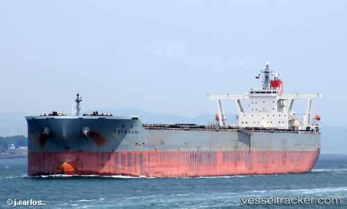
Vessel Toyokuni IMO: 9323572, MMSI: 432714000 Ore Carrier
UTC, -10.56268, 113.69407, course: 55, speed: 9.8
UTC, -10.48767, 113.79631, course: 56, speed: 10.1
2026-02-17 11:44:47 UTC, -10.22597, 114.15173, course: 57, speed: 10.1
Live AIS position:
UTC. 109 nm SW of BENOA),
updated 2026-02-17 11:44:47 UTC.
Find the position of the vessel Toyokuni on the map. The latter are known coordinates and path.
marine traffic ship tracker show on live map
The current position of vessel Toyokuni is -10.22597 lat / 114.15173 lng. Updated: 2026-02-17 11:44:47 UTCDetails:
Last coordinates of the vessel:
UTC, -10.97979, 113.12877, course: 55, speed: 10.4UTC, -10.56268, 113.69407, course: 55, speed: 9.8
UTC, -10.48767, 113.79631, course: 56, speed: 10.1
2026-02-17 11:44:47 UTC, -10.22597, 114.15173, course: 57, speed: 10.1