 vesseltracker.com
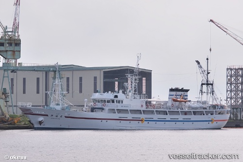
Vessel Shinkai Maru IMO: 9610274, MMSI: 432899000 Fishing Vessel
UTC, 17.51937, -161.23955, course: 44, speed: 9.8
UTC, 17.71583, -161.07362, course: 26, speed: 10.5
2026-02-17 17:37:02 UTC, 17.97298, -160.83742, course: 43, speed: 8.7
Live AIS position:
UTC. 246 nm S of Port Allen),
updated 2026-02-17 17:37:02 UTC.
Find the position of the vessel Shinkai Maru on the map. The latter are known coordinates and path.
marine traffic ship tracker show on live map
The current position of vessel Shinkai Maru is 17.97298 lat / -160.83742 lng. Updated: 2026-02-17 17:37:02 UTCDetails:
Last coordinates of the vessel:
UTC, 17.29571, -161.43773, course: 45, speed: 10.5UTC, 17.51937, -161.23955, course: 44, speed: 9.8
UTC, 17.71583, -161.07362, course: 26, speed: 10.5
2026-02-17 17:37:02 UTC, 17.97298, -160.83742, course: 43, speed: 8.7