 vesseltracker.com
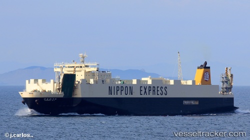
Vessel DAEYANG IMO: 9284233, MMSI: 440172610 Ro-Ro Cargo
UTC, 34.16190, 126.27282, course: 329, speed: 19.8
UTC, 34.16190, 126.27282, course: 329, speed: 19.8
2026-02-24 09:16:31 UTC, 34.16190, 126.27282, course: 329, speed: 19.8
Live AIS position:
UTC. 13 nm N of Chuja),
updated 2026-02-24 09:16:31 UTC.
Find the position of the vessel DAEYANG on the map. The latter are known coordinates and path.
marine traffic ship tracker show on live map
The current position of vessel DAEYANG is 34.16190 lat / 126.27282 lng. Updated: 2026-02-24 09:16:31 UTCCurrently sailing under the flag of South Korea
Details:
Last coordinates of the vessel:
UTC, 33.68547, 126.52275, course: 350, speed: 18.9UTC, 34.16190, 126.27282, course: 329, speed: 19.8
UTC, 34.16190, 126.27282, course: 329, speed: 19.8
2026-02-24 09:16:31 UTC, 34.16190, 126.27282, course: 329, speed: 19.8