 vesseltracker.com
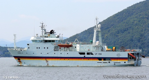
Vessel Tamhae2 IMO: 9131175, MMSI: 440238000 Research Vessel
UTC, 36.91268, 126.23562, course: 62, speed: 0
UTC, 36.91167, 126.23500, course: -1, speed: 0
2026-01-29 20:09:57 UTC, 36.91266, 126.23561, course: 62, speed: 0
Live AIS position:
UTC. Near TAEAN-GUN),
updated 2026-01-29 20:09:57 UTC.
Find the position of the vessel Tamhae2 on the map. The latter are known coordinates and path.
marine traffic ship tracker show on live map
The current position of vessel Tamhae2 is 36.91266 lat / 126.23561 lng. Updated: 2026-01-29 20:09:57 UTCDetails:
Last coordinates of the vessel:
UTC, 36.91266, 126.23561, course: 62, speed: 0UTC, 36.91268, 126.23562, course: 62, speed: 0
UTC, 36.91167, 126.23500, course: -1, speed: 0
2026-01-29 20:09:57 UTC, 36.91266, 126.23561, course: 62, speed: 0