 vesseltracker.com
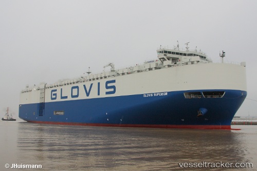
Vessel GLOVIS SUPERIOR IMO: 9674189, MMSI: 441156000 Vehicles Carrier
UTC, -34.51269, 18.23511, course: 100, speed: 16.9
UTC, -34.79172, 19.05771, course: 114, speed: 17.5
2026-03-01 16:18:01 UTC, -35.02319, 19.75733, course: 112, speed: 17.5
Live AIS position:
UTC. 17 nm SW of Cape Agulhas),
updated 2026-03-01 16:18:01 UTC.
Find the position of the vessel GLOVIS SUPERIOR on the map. The latter are known coordinates and path.
marine traffic ship tracker show on live map
The current position of vessel GLOVIS SUPERIOR is -35.02319 lat / 19.75733 lng. Updated: 2026-03-01 16:18:01 UTCCurrently sailing under the flag of Korea (Republic of)
GLOVIS SUPERIOR built in 2013 year
Deadweight:
20138 tDetails:
Last coordinates of the vessel:
UTC, -34.38464, 17.74178, course: 146, speed: 15.6UTC, -34.51269, 18.23511, course: 100, speed: 16.9
UTC, -34.79172, 19.05771, course: 114, speed: 17.5
2026-03-01 16:18:01 UTC, -35.02319, 19.75733, course: 112, speed: 17.5