 vesseltracker.com
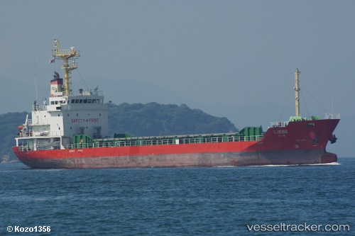
Vessel Liebe IMO: 9623386, MMSI: 441845000 General Cargo Ship
UTC, 33.79928, 131.50027, course: 103, speed: 10.9
UTC, 33.71667, 131.94833, course: -1, speed: 10
2026-01-30 18:01:07 UTC, 33.77097, 132.42912, course: 64, speed: 10.9
Live AIS position:
UTC. 13 nm S of TSUWAJI),
updated 2026-01-30 18:01:07 UTC.
Find the position of the vessel Liebe on the map. The latter are known coordinates and path.
marine traffic ship tracker show on live map
The current position of vessel Liebe is 33.77097 lat / 132.42912 lng. Updated: 2026-01-30 18:01:07 UTCDetails:
Last coordinates of the vessel:
UTC, 33.90806, 131.10672, course: 129, speed: 10.7UTC, 33.79928, 131.50027, course: 103, speed: 10.9
UTC, 33.71667, 131.94833, course: -1, speed: 10
2026-01-30 18:01:07 UTC, 33.77097, 132.42912, course: 64, speed: 10.9