 vesseltracker.com
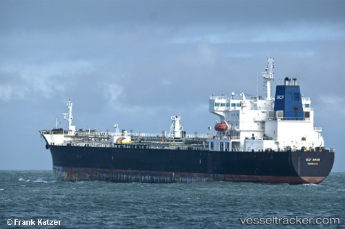
Vessel SOLARIS IMO: 9333436, MMSI: 461000248 Oil Products Tanker
UTC, 16.82990, 56.19603, course: 232, speed: 13.2
UTC, 16.76648, 56.12512, course: 234, speed: 13.6
2026-02-25 14:51:36 UTC, 16.76648, 56.12512, course: 234, speed: 13.6
Live AIS position:
UTC. 121 nm E of Port Raysut),
updated 2026-02-25 14:51:36 UTC.
Find the position of the vessel SOLARIS on the map. The latter are known coordinates and path.
marine traffic ship tracker show on live map
The current position of vessel SOLARIS is 16.76648 lat / 56.12512 lng. Updated: 2026-02-25 14:51:36 UTCCurrently sailing under the flag of Oman
Details:
Last coordinates of the vessel:
UTC, 16.82990, 56.19603, course: 232, speed: 13.2UTC, 16.82990, 56.19603, course: 232, speed: 13.2
UTC, 16.76648, 56.12512, course: 234, speed: 13.6
2026-02-25 14:51:36 UTC, 16.76648, 56.12512, course: 234, speed: 13.6