 vesseltracker.com
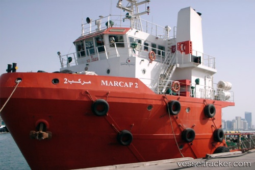
Vessel Marcap 2 IMO: 9292929, MMSI: 470745000 Offshore Tug Supply Ship
UTC, 24.98725, 55.05279, course: 242, speed: 0
UTC, 24.99764, 55.04838, course: 159, speed: 0.2
2026-02-10 22:20:40 UTC, 24.99872, 55.06048, course: 296, speed: 0.1
Live AIS position:
UTC. Near Jebel Ali Free Zone),
updated 2026-02-10 22:20:40 UTC.
Find the position of the vessel Marcap 2 on the map. The latter are known coordinates and path.
marine traffic ship tracker show on live map
The current position of vessel Marcap 2 is 24.99872 lat / 55.06048 lng. Updated: 2026-02-10 22:20:40 UTCDetails:
Last coordinates of the vessel:
UTC, 24.99776, 55.04846, course: 154, speed: 0.2UTC, 24.98725, 55.05279, course: 242, speed: 0
UTC, 24.99764, 55.04838, course: 159, speed: 0.2
2026-02-10 22:20:40 UTC, 24.99872, 55.06048, course: 296, speed: 0.1