 vesseltracker.com
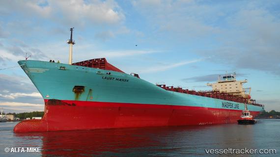
Vessel Laust Maersk IMO: 9190743, MMSI: 477681900 Container Ship
UTC, 10.34270, -75.52258, course: 168, speed: 12.2
UTC, 10.35560, -75.71592, course: 310, speed: 13.3
2026-01-31 13:29:19 UTC, 10.71192, -75.88134, course: 323, speed: 13.5
Live AIS position:
UTC. 28 nm NW of Sociedad Portuaria Regional Cartagena),
updated 2026-01-31 13:29:19 UTC.
Find the position of the vessel Laust Maersk on the map. The latter are known coordinates and path.
marine traffic ship tracker show on live map
The current position of vessel Laust Maersk is 10.71192 lat / -75.88134 lng. Updated: 2026-01-31 13:29:19 UTCCurrently sailing under the flag of Hong Kong
Details:
Last coordinates of the vessel:
UTC, 10.37511, -75.51001, course: 338, speed: 0UTC, 10.34270, -75.52258, course: 168, speed: 12.2
UTC, 10.35560, -75.71592, course: 310, speed: 13.3
2026-01-31 13:29:19 UTC, 10.71192, -75.88134, course: 323, speed: 13.5