 vesseltracker.com
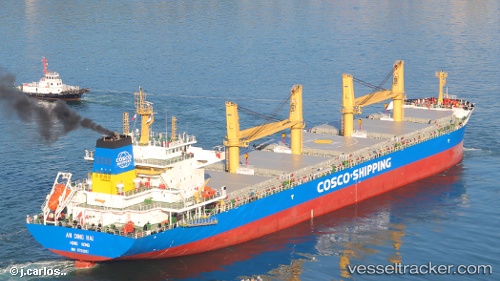
Vessel An Ding Hai IMO: 9751303, MMSI: 477850300 Bulk Carrier
UTC, 25.32500, -86.85167, course: -1, speed: 13
UTC, 25.04167, -86.56500, course: -1, speed: 13
2026-02-17 07:46:25 UTC, 24.87667, -86.24166, course: -1, speed: 14
Live AIS position:
UTC. 179 nm W of Florida Straits),
updated 2026-02-17 07:46:25 UTC.
Find the position of the vessel An Ding Hai on the map. The latter are known coordinates and path.
marine traffic ship tracker show on live map
The current position of vessel An Ding Hai is 24.87667 lat / -86.24166 lng. Updated: 2026-02-17 07:46:25 UTCCurrently sailing under the flag of Hong Kong
Details:
Last coordinates of the vessel:
UTC, 25.69500, -87.19500, course: -1, speed: 13UTC, 25.32500, -86.85167, course: -1, speed: 13
UTC, 25.04167, -86.56500, course: -1, speed: 13
2026-02-17 07:46:25 UTC, 24.87667, -86.24166, course: -1, speed: 14