 vesseltracker.com
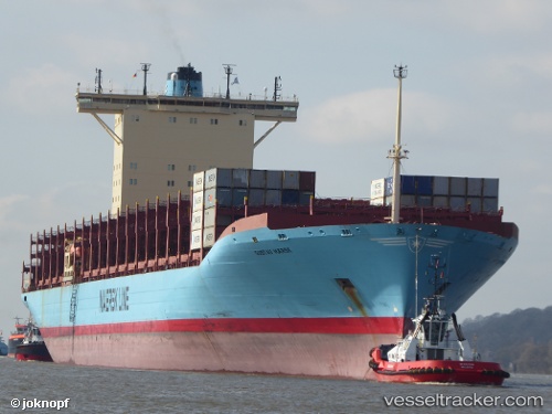
Vessel GUSTAV MAERSK IMO: 9359038, MMSI: 477928700 Container Ship
UTC, 43.40691, -147.47142, course: 109, speed: 14.6
UTC, 43.25167, -146.88667, course: -1, speed: 15
2026-02-28 04:03:45 UTC, 43.02664, -146.09988, course: 110, speed: 14.8
Live AIS position:
UTC. 203 nm S of Lukovica pri Domzalah),
updated 2026-02-28 04:03:45 UTC.
Find the position of the vessel GUSTAV MAERSK on the map. The latter are known coordinates and path.
marine traffic ship tracker show on live map
The current position of vessel GUSTAV MAERSK is 43.02664 lat / -146.09988 lng. Updated: 2026-02-28 04:03:45 UTCCurrently sailing under the flag of Hong Kong
Details:
Last coordinates of the vessel:
UTC, 43.49906, -147.81992, course: 111, speed: 14.2UTC, 43.40691, -147.47142, course: 109, speed: 14.6
UTC, 43.25167, -146.88667, course: -1, speed: 15
2026-02-28 04:03:45 UTC, 43.02664, -146.09988, course: 110, speed: 14.8