 vesseltracker.com
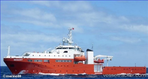
Vessel Besant IMO: 9676149, MMSI: 503000092 Search And Rescue Vessel
UTC, 1.46444, 103.82368, course: 211, speed: 0
UTC, 1.46442, 103.82373, course: 211, speed: 0
2026-01-29 11:58:28 UTC, 1.46444, 103.82371, course: 211, speed: 0
Live AIS position:
UTC. Near SEMBAWANG),
updated 2026-01-29 11:58:28 UTC.
Find the position of the vessel Besant on the map. The latter are known coordinates and path.
marine traffic ship tracker show on live map
The current position of vessel Besant is 1.46444 lat / 103.82371 lng. Updated: 2026-01-29 11:58:28 UTCCurrently sailing under the flag of Australia
Details:
Last coordinates of the vessel:
UTC, 1.46442, 103.82367, course: 210, speed: 0UTC, 1.46444, 103.82368, course: 211, speed: 0
UTC, 1.46442, 103.82373, course: 211, speed: 0
2026-01-29 11:58:28 UTC, 1.46444, 103.82371, course: 211, speed: 0