 vesseltracker.com
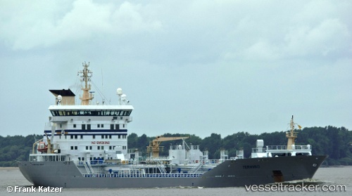
Vessel LADY AMIRA 1 IMO: 9277371, MMSI: 511101256 Chemical Oil Products Tanker
UTC, 25.71230, 56.90143, course: 191, speed: 0
UTC, 25.71201, 56.90107, course: 168, speed: 0.1
2026-02-14 01:22:25 UTC, 25.71198, 56.90194, course: 174, speed: 0
Live AIS position:
UTC. 31 nm NE of Offshore Fujairah),
updated 2026-02-14 01:22:25 UTC.
Find the position of the vessel LADY AMIRA 1 on the map. The latter are known coordinates and path.
marine traffic ship tracker show on live map
The current position of vessel LADY AMIRA 1 is 25.71198 lat / 56.90194 lng. Updated: 2026-02-14 01:22:25 UTCCurrently sailing under the flag of Palau
LADY AMIRA 1 built in 2003 year
Deadweight:
14803 tDetails:
Last coordinates of the vessel:
UTC, 25.71239, 56.90146, course: 196, speed: 0UTC, 25.71230, 56.90143, course: 191, speed: 0
UTC, 25.71201, 56.90107, course: 168, speed: 0.1
2026-02-14 01:22:25 UTC, 25.71198, 56.90194, course: 174, speed: 0