 vesseltracker.com
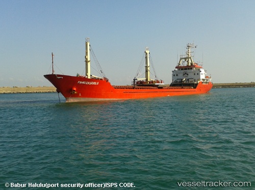
Vessel DOGANBEY IMO: 9111761, MMSI: 511101394 General Cargo
UTC, 43.83595, 28.73468, course: 187, speed: 10.4
UTC, 43.78306, 28.73078, course: 185, speed: 10.4
2026-02-25 12:34:53 UTC, 43.78306, 28.73078, course: 185, speed: 10.4
Live AIS position:
UTC. Near MANGALIA),
updated 2026-02-25 12:34:53 UTC.
Find the position of the vessel DOGANBEY on the map. The latter are known coordinates and path.
marine traffic ship tracker show on live map
The current position of vessel DOGANBEY is 43.78306 lat / 28.73078 lng. Updated: 2026-02-25 12:34:53 UTCCurrently sailing under the flag of Palau
Details:
Last coordinates of the vessel:
UTC, 44.09998, 28.65745, course: -1, speed: 0UTC, 43.83595, 28.73468, course: 187, speed: 10.4
UTC, 43.78306, 28.73078, course: 185, speed: 10.4
2026-02-25 12:34:53 UTC, 43.78306, 28.73078, course: 185, speed: 10.4