 vesseltracker.com
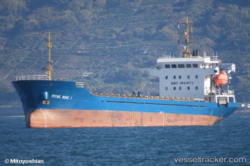
Vessel RYONG BONG 1 IMO: 8648573, MMSI: 511101570 Cargo
UTC, 36.93032, 140.87344, course: 210, speed: 0.1
UTC, 36.93034, 140.87344, course: -1, speed: 0.1
2026-03-03 03:26:34 UTC, 36.90503, 140.88177, course: 108, speed: 7.9
Live AIS position:
UTC. Near ONAHAMA),
updated 2026-03-03 03:26:34 UTC.
Find the position of the vessel RYONG BONG 1 on the map. The latter are known coordinates and path.
marine traffic ship tracker show on live map
The current position of vessel RYONG BONG 1 is 36.90503 lat / 140.88177 lng. Updated: 2026-03-03 03:26:34 UTCCurrently sailing under the flag of Palau
Details:
Last coordinates of the vessel:
UTC, 36.93032, 140.87344, course: -1, speed: 0.1UTC, 36.93032, 140.87344, course: 210, speed: 0.1
UTC, 36.93034, 140.87344, course: -1, speed: 0.1
2026-03-03 03:26:34 UTC, 36.90503, 140.88177, course: 108, speed: 7.9