 vesseltracker.com
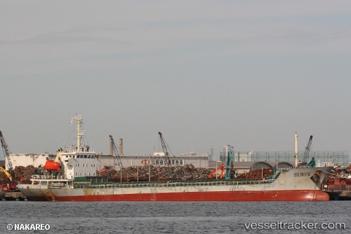
Vessel BROTHER 36 IMO: 8743531, MMSI: 511101871 Cargo
UTC, 20.93333, 107.06667, course: -1, speed: 0
UTC, 20.93267, 107.06707, course: -1, speed: 0
2026-02-28 21:33:47 UTC, 20.93202, 107.06769, course: 359, speed: 0
Live AIS position:
UTC. Near Ha Long),
updated 2026-02-28 21:33:47 UTC.
Find the position of the vessel BROTHER 36 on the map. The latter are known coordinates and path.
marine traffic ship tracker show on live map
The current position of vessel BROTHER 36 is 20.93202 lat / 107.06769 lng. Updated: 2026-02-28 21:33:47 UTCCurrently sailing under the flag of Palau
Details:
Last coordinates of the vessel:
UTC, 20.93333, 107.06724, course: 133, speed: 0UTC, 20.93333, 107.06667, course: -1, speed: 0
UTC, 20.93267, 107.06707, course: -1, speed: 0
2026-02-28 21:33:47 UTC, 20.93202, 107.06769, course: 359, speed: 0