 vesseltracker.com
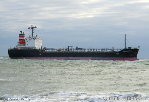
Vessel S M A IMO: 9273002, MMSI: 518100962 Chemical/Oil Products Tanker
UTC, 25.39848, 56.49581, course: -1, speed: 0.1
UTC, 25.39848, 56.49581, course: -1, speed: 0.1
2026-02-06 08:59:24 UTC, 25.39848, 56.49581, course: -1, speed: 0.1
Live AIS position:
UTC. Near KHORFAKKAN),
updated 2026-02-06 08:59:24 UTC.
Find the position of the vessel S M A on the map. The latter are known coordinates and path.
marine traffic ship tracker show on live map
The current position of vessel S M A is 25.39848 lat / 56.49581 lng. Updated: 2026-02-06 08:59:24 UTCCurrently sailing under the flag of Cook islands
S M A built in 2003 year
Deadweight:
7717 tDetails:
Last coordinates of the vessel:
UTC, 25.39834, 56.49583, course: -1, speed: 0.1UTC, 25.39848, 56.49581, course: -1, speed: 0.1
UTC, 25.39848, 56.49581, course: -1, speed: 0.1
2026-02-06 08:59:24 UTC, 25.39848, 56.49581, course: -1, speed: 0.1