 vesseltracker.com
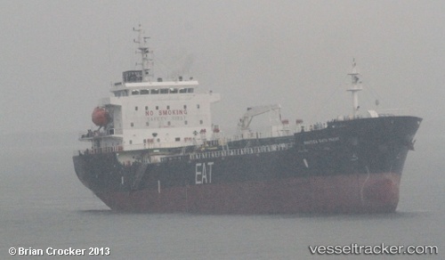
Vessel SUA IMO: 9546710, MMSI: 518998458 Oil Products Tanker
UTC, 25.35934, 56.36751, course: 331, speed: 0
UTC, 25.35934, 56.36751, course: 331, speed: 0
2026-01-30 15:46:32 UTC, 25.35934, 56.36751, course: 331, speed: 0
Live AIS position:
UTC. Near KHORFAKKAN),
updated 2026-01-30 15:46:32 UTC.
Find the position of the vessel SUA on the map. The latter are known coordinates and path.
marine traffic ship tracker show on live map
The current position of vessel SUA is 25.35934 lat / 56.36751 lng. Updated: 2026-01-30 15:46:32 UTCCurrently sailing under the flag of Cook islands
SUA built in 2010 year
Deadweight:
9985 tDetails:
Last coordinates of the vessel:
UTC, 25.35934, 56.36752, course: 331, speed: 0UTC, 25.35934, 56.36751, course: 331, speed: 0
UTC, 25.35934, 56.36751, course: 331, speed: 0
2026-01-30 15:46:32 UTC, 25.35934, 56.36751, course: 331, speed: 0