 vesseltracker.com
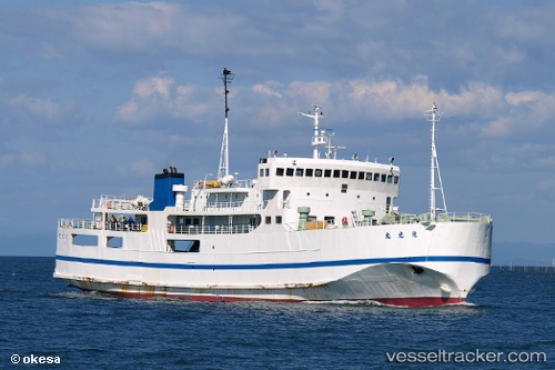
Vessel Star Belitung IMO: 7214650, MMSI: 525020168 Passenger Ro Ro Cargo Ship
UTC, -2.62869, 106.89889, course: -1, speed: 10.2
UTC, -2.62869, 106.89889, course: -1, speed: 10.2
2026-03-03 12:57:21 UTC, -2.62869, 106.89889, course: -1, speed: 10.2
Live Vessel Star Belitung Analytics (details, animations, etc.)
Live AIS position: UTC. 30 nm NE of Serdang), updated 2026-03-03 12:57:21 UTC.Find the position of the vessel Star Belitung on the map. The latter are known coordinates and path.
marine traffic ship tracker show on live map
The current position of vessel Star Belitung is -2.62869 lat / 106.89889 lng. Updated: 2026-03-03 12:57:21 UTCCurrently sailing under the flag of Indonesia
Details:
Last coordinates of the vessel:
UTC, -2.82167, 106.95191, course: -1, speed: 10.2UTC, -2.62869, 106.89889, course: -1, speed: 10.2
UTC, -2.62869, 106.89889, course: -1, speed: 10.2
2026-03-03 12:57:21 UTC, -2.62869, 106.89889, course: -1, speed: 10.2