 vesseltracker.com
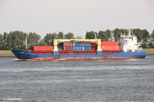
Vessel Meratus Sangatta IMO: 9116797, MMSI: 525025072 Multi Purpose Carrier
UTC, -5.23983, 110.89991, course: 13, speed: 7.9
UTC, -5.23983, 110.89991, course: 13, speed: 7.9
2026-01-30 13:48:38 UTC, -4.65489, 111.13139, course: 19, speed: 8
Live AIS position:
UTC. 110 nm N of TANJUNG JATI),
updated 2026-01-30 13:48:38 UTC.
Find the position of the vessel Meratus Sangatta on the map. The latter are known coordinates and path.
marine traffic ship tracker show on live map
The current position of vessel Meratus Sangatta is -4.65489 lat / 111.13139 lng. Updated: 2026-01-30 13:48:38 UTCDetails:
Last coordinates of the vessel:
UTC, -5.35573, 110.85446, course: 13, speed: 7.9UTC, -5.23983, 110.89991, course: 13, speed: 7.9
UTC, -5.23983, 110.89991, course: 13, speed: 7.9
2026-01-30 13:48:38 UTC, -4.65489, 111.13139, course: 19, speed: 8