 vesseltracker.com
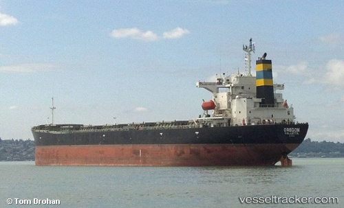
Vessel MARIA NASHWAH IMO: 9214123, MMSI: 525120012 Bulk Carrier
UTC, -5.77609, 115.15406, course: 36, speed: 12.3
UTC, -5.34039, 115.48658, course: 38, speed: 12.1
2026-01-29 23:11:09 UTC, -4.97419, 115.78796, course: 48, speed: 12.2
Live AIS position:
UTC. 59 nm S of MEKAR PUTIH),
updated 2026-01-29 23:11:09 UTC.
Find the position of the vessel MARIA NASHWAH on the map. The latter are known coordinates and path.
marine traffic ship tracker show on live map
The current position of vessel MARIA NASHWAH is -4.97419 lat / 115.78796 lng. Updated: 2026-01-29 23:11:09 UTCCurrently sailing under the flag of Indonesia
MARIA NASHWAH built in 2002 year
Deadweight:
74204 tDetails:
Last coordinates of the vessel:
UTC, -5.84034, 115.10471, course: 36, speed: 12.3UTC, -5.77609, 115.15406, course: 36, speed: 12.3
UTC, -5.34039, 115.48658, course: 38, speed: 12.1
2026-01-29 23:11:09 UTC, -4.97419, 115.78796, course: 48, speed: 12.2