 vesseltracker.com
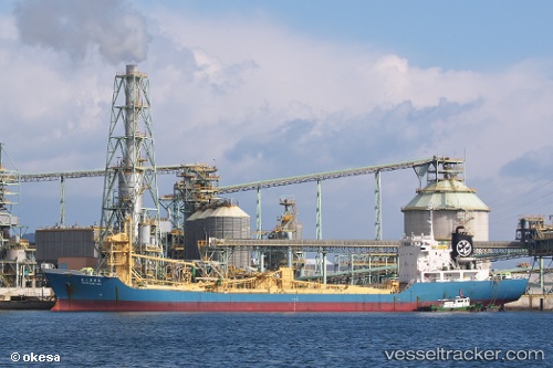
Vessel Ryoko 8 IMO: 9015096, MMSI: 525300009 Cement Carrier
UTC, -3.27345, 116.15141, course: -1, speed: 0.1
UTC, -3.27320, 116.15102, course: -1, speed: 0
2026-02-24 20:30:40 UTC, -3.27322, 116.15087, course: -1, speed: 0
Live AIS position:
UTC. Near Pulau Laut),
updated 2026-02-24 20:30:40 UTC.
Find the position of the vessel Ryoko 8 on the map. The latter are known coordinates and path.
marine traffic ship tracker show on live map
The current position of vessel Ryoko 8 is -3.27322 lat / 116.15087 lng. Updated: 2026-02-24 20:30:40 UTCDetails:
Last coordinates of the vessel:
UTC, -3.27333, 116.15167, course: -1, speed: 0UTC, -3.27345, 116.15141, course: -1, speed: 0.1
UTC, -3.27320, 116.15102, course: -1, speed: 0
2026-02-24 20:30:40 UTC, -3.27322, 116.15087, course: -1, speed: 0