 vesseltracker.com
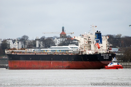
Vessel Ecostar G.o. IMO: 9386421, MMSI: 538002999 Bulk Carrier
UTC, -27.41812, -39.31286, course: 117, speed: 11.8
UTC, -27.58167, -38.89167, course: -1, speed: 11
2026-03-01 16:19:58 UTC, -27.77905, -38.40939, course: 114, speed: 11.2
Live AIS position:
UTC. 273 nm SE of Cidade de Angra dos Reis FPSO),
updated 2026-03-01 16:19:58 UTC.
Find the position of the vessel Ecostar G.o. on the map. The latter are known coordinates and path.
marine traffic ship tracker show on live map
The current position of vessel Ecostar G.o. is -27.77905 lat / -38.40939 lng. Updated: 2026-03-01 16:19:58 UTCDetails:
Last coordinates of the vessel:
UTC, -27.29362, -39.64920, course: 114, speed: 11.7UTC, -27.41812, -39.31286, course: 117, speed: 11.8
UTC, -27.58167, -38.89167, course: -1, speed: 11
2026-03-01 16:19:58 UTC, -27.77905, -38.40939, course: 114, speed: 11.2