 vesseltracker.com
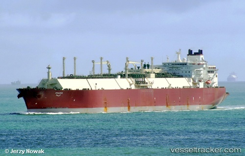
Vessel Fraiha IMO: 9360817, MMSI: 538003101 Lng Tanker
UTC, -6.67380, 51.24799, course: 216, speed: 15.5
UTC, -7.12940, 50.92666, course: 216, speed: 14.6
2026-02-17 11:42:41 UTC, -7.53245, 50.62837, course: 212, speed: 15.6
Live AIS position:
UTC. 213 nm SW of Ile Desroches),
updated 2026-02-17 11:42:41 UTC.
Find the position of the vessel Fraiha on the map. The latter are known coordinates and path.
marine traffic ship tracker show on live map
The current position of vessel Fraiha is -7.53245 lat / 50.62837 lng. Updated: 2026-02-17 11:42:41 UTCCurrently sailing under the flag of Marshall Is
Fraiha built in 2008 year
Deadweight:
121914 tDetails:
Last coordinates of the vessel:
UTC, -6.22870, 51.57104, course: 217, speed: 15.5UTC, -6.67380, 51.24799, course: 216, speed: 15.5
UTC, -7.12940, 50.92666, course: 216, speed: 14.6
2026-02-17 11:42:41 UTC, -7.53245, 50.62837, course: 212, speed: 15.6