 vesseltracker.com
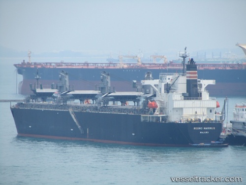
Vessel Regno Marinus IMO: 9343467, MMSI: 538003251 Wood Chips Carrier
UTC, 1.22628, 103.44020, course: 292, speed: 11.2
UTC, 1.61119, 102.99882, course: 309, speed: 12.7
2026-02-17 10:01:49 UTC, 1.74115, 102.71311, course: 296, speed: 11.4
Live AIS position:
UTC. 25 nm W of Parit Raja),
updated 2026-02-17 10:01:49 UTC.
Find the position of the vessel Regno Marinus on the map. The latter are known coordinates and path.
marine traffic ship tracker show on live map
The current position of vessel Regno Marinus is 1.74115 lat / 102.71311 lng. Updated: 2026-02-17 10:01:49 UTCDetails:
Last coordinates of the vessel:
UTC, 1.16029, 103.77305, course: 241, speed: 8.5UTC, 1.22628, 103.44020, course: 292, speed: 11.2
UTC, 1.61119, 102.99882, course: 309, speed: 12.7
2026-02-17 10:01:49 UTC, 1.74115, 102.71311, course: 296, speed: 11.4