 vesseltracker.com
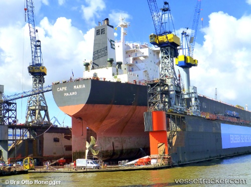
Vessel Cape Maria IMO: 9282431, MMSI: 538003928 Bulk Carrier
UTC, -22.35398, -1.04312, course: 323, speed: 10.3
UTC, -21.99833, -1.32333, course: -1, speed: 10
2026-02-19 10:00:48 UTC, -21.76500, -1.50833, course: -1, speed: 10
Live AIS position:
UTC. Open sea, approx. 424 nm off the nearest listed port),
updated 2026-02-19 10:00:48 UTC.
Find the position of the vessel Cape Maria on the map. The latter are known coordinates and path.
marine traffic ship tracker show on live map
The current position of vessel Cape Maria is -21.76500 lat / -1.50833 lng. Updated: 2026-02-19 10:00:48 UTCDetails:
Last coordinates of the vessel:
UTC, -22.64517, -0.80650, course: 323, speed: 10.1UTC, -22.35398, -1.04312, course: 323, speed: 10.3
UTC, -21.99833, -1.32333, course: -1, speed: 10
2026-02-19 10:00:48 UTC, -21.76500, -1.50833, course: -1, speed: 10