 vesseltracker.com
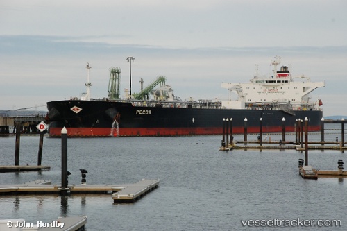
Vessel Pecos IMO: 9594743, MMSI: 538004032 Crude Oil Tanker
UTC, 34.08564, -29.63123, course: 84, speed: 12.1
UTC, 34.14326, -29.02353, course: 82, speed: 12.1
2026-02-27 13:50:13 UTC, 34.19370, -28.57033, course: 83, speed: 11.9
Live AIS position:
UTC. 234 nm SW of Villa Do Porto),
updated 2026-02-27 13:50:13 UTC.
Find the position of the vessel Pecos on the map. The latter are known coordinates and path.
marine traffic ship tracker show on live map
The current position of vessel Pecos is 34.19370 lat / -28.57033 lng. Updated: 2026-02-27 13:50:13 UTCDetails:
Last coordinates of the vessel:
UTC, 34.03529, -30.14072, course: 86, speed: 12.8UTC, 34.08564, -29.63123, course: 84, speed: 12.1
UTC, 34.14326, -29.02353, course: 82, speed: 12.1
2026-02-27 13:50:13 UTC, 34.19370, -28.57033, course: 83, speed: 11.9