 vesseltracker.com
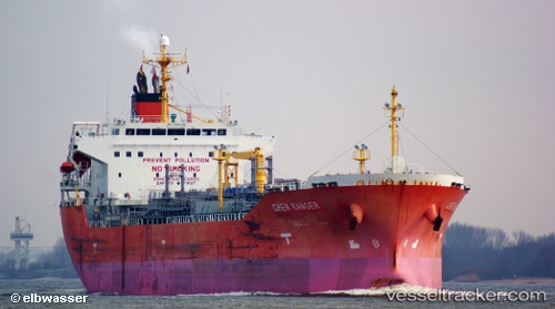
Vessel Chem Ranger IMO: 9490296, MMSI: 538004628 Chemical Oil Products Tanker
UTC, -29.47767, 32.82897, course: 68, speed: 11.7
UTC, -29.38258, 33.27147, course: 72, speed: 12.8
2026-02-28 11:58:20 UTC, -29.25012, 33.87242, course: 77, speed: 13.8
Live AIS position:
UTC. 95 nm E of Richards Bay),
updated 2026-02-28 11:58:20 UTC.
Find the position of the vessel Chem Ranger on the map. The latter are known coordinates and path.
marine traffic ship tracker show on live map
The current position of vessel Chem Ranger is -29.25012 lat / 33.87242 lng. Updated: 2026-02-28 11:58:20 UTCCurrently sailing under the flag of Marshall Is
Chem Ranger built in 2010 year
Deadweight:
26198 tDetails:
Last coordinates of the vessel:
UTC, -29.56388, 32.42787, course: 65, speed: 10.9UTC, -29.47767, 32.82897, course: 68, speed: 11.7
UTC, -29.38258, 33.27147, course: 72, speed: 12.8
2026-02-28 11:58:20 UTC, -29.25012, 33.87242, course: 77, speed: 13.8