 vesseltracker.com
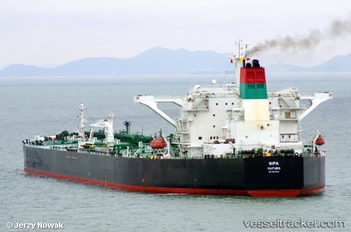
Vessel SIFA IMO: 9441245, MMSI: 538004634 Crude Oil Tanker
UTC, 21.42333, 69.01167, course: -1, speed: 10
UTC, 21.08916, 69.11890, course: 132, speed: 9.4
2026-01-29 07:51:12 UTC, 20.85787, 69.15332, course: 161, speed: 9.5
Live AIS position:
UTC. 68 nm W of Veraval),
updated 2026-01-29 07:51:12 UTC.
Find the position of the vessel SIFA on the map. The latter are known coordinates and path.
marine traffic ship tracker show on live map
The current position of vessel SIFA is 20.85787 lat / 69.15332 lng. Updated: 2026-01-29 07:51:12 UTCCurrently sailing under the flag of Marshall Islands
SIFA built in 2011 year
Deadweight:
316373 tDetails:
Last coordinates of the vessel:
UTC, 21.78514, 68.87731, course: 160, speed: 10.1UTC, 21.42333, 69.01167, course: -1, speed: 10
UTC, 21.08916, 69.11890, course: 132, speed: 9.4
2026-01-29 07:51:12 UTC, 20.85787, 69.15332, course: 161, speed: 9.5