 vesseltracker.com
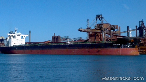
Vessel Mariloula IMO: 9434553, MMSI: 538004701 Bulk Carrier
UTC, -33.05007, 17.98890, course: 30, speed: 0
UTC, -33.04968, 17.98833, course: 48, speed: 0
2026-02-17 05:58:53 UTC, -33.04813, 17.98782, course: 82, speed: 0.1
Live AIS position:
UTC. Near SALDANHA),
updated 2026-02-17 05:58:53 UTC.
Find the position of the vessel Mariloula on the map. The latter are known coordinates and path.
marine traffic ship tracker show on live map
The current position of vessel Mariloula is -33.04813 lat / 17.98782 lng. Updated: 2026-02-17 05:58:53 UTCDetails:
Last coordinates of the vessel:
UTC, -33.04898, 17.99310, course: 290, speed: 0UTC, -33.05007, 17.98890, course: 30, speed: 0
UTC, -33.04968, 17.98833, course: 48, speed: 0
2026-02-17 05:58:53 UTC, -33.04813, 17.98782, course: 82, speed: 0.1