 vesseltracker.com
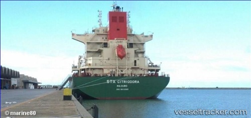
Vessel Citriodora IMO: 9613305, MMSI: 538004997 General Cargo Ship
UTC, -32.56317, 31.84845, course: 251, speed: 12.7
UTC, -32.75762, 31.25002, course: 248, speed: 12.6
2026-02-23 02:08:46 UTC, -32.91598, 30.79870, course: 246, speed: 13.8
Live AIS position:
UTC. 100 nm SE of Port Saint John's),
updated 2026-02-23 02:08:46 UTC.
Find the position of the vessel Citriodora on the map. The latter are known coordinates and path.
marine traffic ship tracker show on live map
The current position of vessel Citriodora is -32.91598 lat / 30.79870 lng. Updated: 2026-02-23 02:08:46 UTCCurrently sailing under the flag of Marshall Is
Citriodora built in 2013 year
Deadweight:
57440 tDetails:
Last coordinates of the vessel:
UTC, -32.41877, 32.32687, course: 252, speed: 12.5UTC, -32.56317, 31.84845, course: 251, speed: 12.7
UTC, -32.75762, 31.25002, course: 248, speed: 12.6
2026-02-23 02:08:46 UTC, -32.91598, 30.79870, course: 246, speed: 13.8