 vesseltracker.com
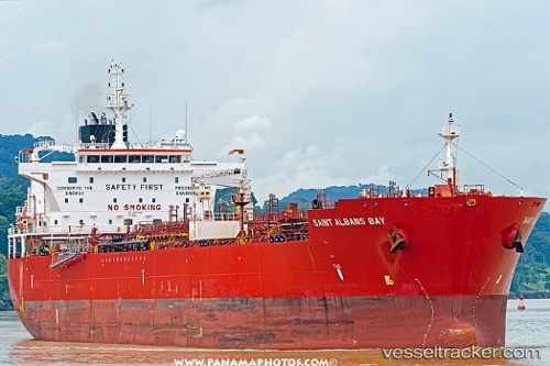
Vessel Saint Albans Bay IMO: 9697648, MMSI: 538005189 Chemical Oil Products Tanker
UTC, 9.43477, -79.92055, course: 170, speed: 8.2
UTC, 9.33131, -79.91967, course: 178, speed: 6.7
2026-02-17 14:30:32 UTC, 9.18357, -79.87660, course: 119, speed: 5.6
Live AIS position:
UTC. Near Monte Lirio),
updated 2026-02-17 14:30:32 UTC.
Find the position of the vessel Saint Albans Bay on the map. The latter are known coordinates and path.
marine traffic ship tracker show on live map
The current position of vessel Saint Albans Bay is 9.18357 lat / -79.87660 lng. Updated: 2026-02-17 14:30:32 UTCDetails:
Last coordinates of the vessel:
UTC, 9.42465, -79.95367, course: 313, speed: 0.2UTC, 9.43477, -79.92055, course: 170, speed: 8.2
UTC, 9.33131, -79.91967, course: 178, speed: 6.7
2026-02-17 14:30:32 UTC, 9.18357, -79.87660, course: 119, speed: 5.6