 vesseltracker.com
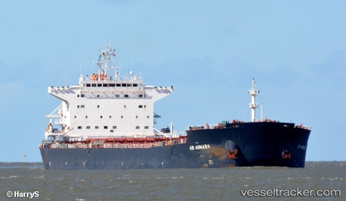
Vessel Am Annaba IMO: 9669330, MMSI: 538005216 Bulk Carrier
UTC, 39.05331, 131.45006, course: 23, speed: 11.6
UTC, 41.07415, 132.48077, course: 25, speed: 10.4
2026-01-31 07:36:13 UTC, 41.59253, 132.75658, course: 18, speed: 11
Live AIS position:
UTC. 68 nm S of Kozmino Port),
updated 2026-01-31 07:36:13 UTC.
Find the position of the vessel Am Annaba on the map. The latter are known coordinates and path.
marine traffic ship tracker show on live map
The current position of vessel Am Annaba is 41.59253 lat / 132.75658 lng. Updated: 2026-01-31 07:36:13 UTCCurrently sailing under the flag of Marshall Is
Am Annaba built in 2013 year
Deadweight:
76079 tDetails:
Last coordinates of the vessel:
UTC, 39.05331, 131.45006, course: 23, speed: 11.6UTC, 39.05331, 131.45006, course: 23, speed: 11.6
UTC, 41.07415, 132.48077, course: 25, speed: 10.4
2026-01-31 07:36:13 UTC, 41.59253, 132.75658, course: 18, speed: 11