 vesseltracker.com
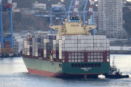
Vessel Maersk Lome IMO: 9694593, MMSI: 538005750 Container Ship
UTC, -5.53470, -34.87483, course: 160, speed: 10.9
UTC, -5.90025, -34.75892, course: 162, speed: 11
2026-02-28 10:14:56 UTC, -6.34581, -34.60984, course: 160, speed: 11
Live AIS position:
UTC. 24 nm E of Baia Formosa),
updated 2026-02-28 10:14:56 UTC.
Find the position of the vessel Maersk Lome on the map. The latter are known coordinates and path.
marine traffic ship tracker show on live map
The current position of vessel Maersk Lome is -6.34581 lat / -34.60984 lng. Updated: 2026-02-28 10:14:56 UTCCurrently sailing under the flag of Marshall Is
Details:
Last coordinates of the vessel:
UTC, -5.32392, -34.94605, course: 159, speed: 10.7UTC, -5.53470, -34.87483, course: 160, speed: 10.9
UTC, -5.90025, -34.75892, course: 162, speed: 11
2026-02-28 10:14:56 UTC, -6.34581, -34.60984, course: 160, speed: 11