 vesseltracker.com
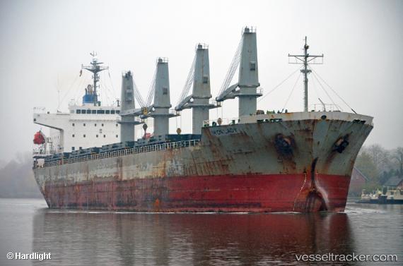
Vessel Iron Lady IMO: 9385099, MMSI: 538007273 Bulk Carrier
UTC, -5.41103, -81.27666, course: 176, speed: 12.4
UTC, -5.66173, -81.26827, course: 176, speed: 12.6
2026-02-18 20:25:41 UTC, -6.21523, -81.22100, course: 158, speed: 12
Live AIS position:
UTC. 24 nm SW of Bayovar),
updated 2026-02-18 20:25:41 UTC.
Find the position of the vessel Iron Lady on the map. The latter are known coordinates and path.
marine traffic ship tracker show on live map
The current position of vessel Iron Lady is -6.21523 lat / -81.22100 lng. Updated: 2026-02-18 20:25:41 UTCCurrently sailing under the flag of Marshall Is
Iron Lady built in 2009 year
Deadweight:
32283 tDetails:
Last coordinates of the vessel:
UTC, -5.08144, -81.10850, course: 152, speed: 0UTC, -5.41103, -81.27666, course: 176, speed: 12.4
UTC, -5.66173, -81.26827, course: 176, speed: 12.6
2026-02-18 20:25:41 UTC, -6.21523, -81.22100, course: 158, speed: 12