 vesseltracker.com
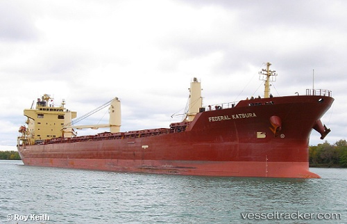
Vessel FEDERAL KATSURA IMO: 9293923, MMSI: 538007353 Bulk Carrier
UTC, 54.62027, -5.89956, course: 39, speed: 0
UTC, 54.62026, -5.89957, course: 39, speed: 0
2026-02-05 06:21:45 UTC, 54.62024, -5.89954, course: 39, speed: 0
Live AIS position:
UTC. Near Belfast),
updated 2026-02-05 06:21:45 UTC.
Find the position of the vessel FEDERAL KATSURA on the map. The latter are known coordinates and path.
marine traffic ship tracker show on live map
The current position of vessel FEDERAL KATSURA is 54.62024 lat / -5.89954 lng. Updated: 2026-02-05 06:21:45 UTCCurrently sailing under the flag of Marshall Islands
FEDERAL KATSURA built in 2005 year
Deadweight:
32594 tDetails:
Last coordinates of the vessel:
UTC, 54.62024, -5.89957, course: 39, speed: 0UTC, 54.62027, -5.89956, course: 39, speed: 0
UTC, 54.62026, -5.89957, course: 39, speed: 0
2026-02-05 06:21:45 UTC, 54.62024, -5.89954, course: 39, speed: 0