 vesseltracker.com
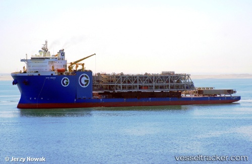
Vessel Gpo Grace IMO: 9760421, MMSI: 538007446 Heavy Load Carrier
UTC, 37.89833, -66.90333, course: -1, speed: 8
UTC, 37.90035, -66.56483, course: 82, speed: 8.9
2026-03-01 21:24:18 UTC, 37.90001, -66.19290, course: 64, speed: 8.5
Live AIS position:
UTC. 272 nm SE of NANTUCKET),
updated 2026-03-01 21:24:18 UTC.
Find the position of the vessel Gpo Grace on the map. The latter are known coordinates and path.
marine traffic ship tracker show on live map
The current position of vessel Gpo Grace is 37.90001 lat / -66.19290 lng. Updated: 2026-03-01 21:24:18 UTCDetails:
Last coordinates of the vessel:
UTC, 37.89500, -67.24667, course: -1, speed: 9UTC, 37.89833, -66.90333, course: -1, speed: 8
UTC, 37.90035, -66.56483, course: 82, speed: 8.9
2026-03-01 21:24:18 UTC, 37.90001, -66.19290, course: 64, speed: 8.5