 vesseltracker.com
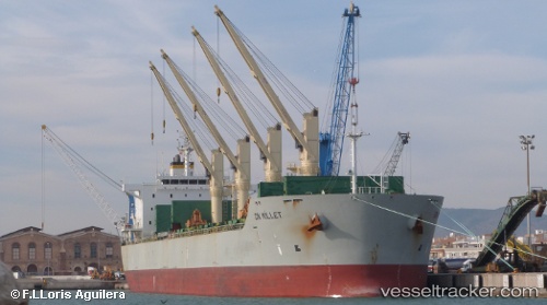
Vessel Amilla IMO: 9498561, MMSI: 538007893 Bulk Carrier
UTC, 11.24986, 55.02887, course: 186, speed: 12.4
UTC, 10.76738, 54.92040, course: 202, speed: 12.7
2026-02-28 22:58:46 UTC, 10.66077, 54.87475, course: 200, speed: 12.8
Live AIS position:
UTC. 122 nm SE of Suqutrá),
updated 2026-02-28 22:58:46 UTC.
Find the position of the vessel Amilla on the map. The latter are known coordinates and path.
marine traffic ship tracker show on live map
The current position of vessel Amilla is 10.66077 lat / 54.87475 lng. Updated: 2026-02-28 22:58:46 UTCCurrently sailing under the flag of Marshall Is
Amilla built in 2011 year
Deadweight:
58444 tDetails:
Last coordinates of the vessel:
UTC, 12.20718, 55.16820, course: 194, speed: 13.1UTC, 11.24986, 55.02887, course: 186, speed: 12.4
UTC, 10.76738, 54.92040, course: 202, speed: 12.7
2026-02-28 22:58:46 UTC, 10.66077, 54.87475, course: 200, speed: 12.8