 vesseltracker.com
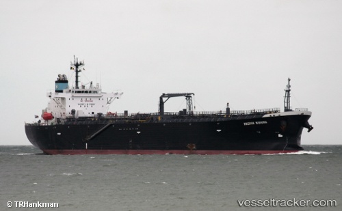
Vessel Atalanta T IMO: 9450789, MMSI: 538008124 Oil Products Tanker
UTC, -31.27359, 114.40397, course: 125, speed: 12.1
UTC, -31.32284, 114.47572, course: 125, speed: 12.1
2026-01-20 00:27:15 UTC, -31.59637, 114.87732, course: 124, speed: 13.2
Live AIS position:
UTC. 42 nm NW of ROTTNEST ISLAND),
updated 2026-01-20 00:27:15 UTC.
Find the position of the vessel Atalanta T on the map. The latter are known coordinates and path.
marine traffic ship tracker show on live map
The current position of vessel Atalanta T is -31.59637 lat / 114.87732 lng. Updated: 2026-01-20 00:27:15 UTCDetails:
Last coordinates of the vessel:
UTC, -31.10851, 114.13648, course: 120, speed: 11.8UTC, -31.27359, 114.40397, course: 125, speed: 12.1
UTC, -31.32284, 114.47572, course: 125, speed: 12.1
2026-01-20 00:27:15 UTC, -31.59637, 114.87732, course: 124, speed: 13.2