 vesseltracker.com
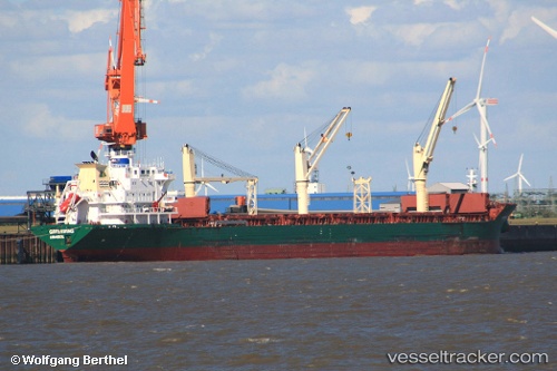
Vessel GREENWING IMO: 9230921, MMSI: 538008597 Bulk Carrier
UTC, 19.48303, -95.99142, course: 358, speed: 2
2026-02-24 22:34:55 UTC, 19.48303, -95.99142, course: 358, speed: 2
Live AIS position:
UTC. 19 nm NE of Veracruz),
updated 2026-02-24 22:34:55 UTC.
Find the position of the vessel GREENWING on the map. The latter are known coordinates and path.
marine traffic ship tracker show on live map
The current position of vessel GREENWING is 19.48303 lat / -95.99142 lng. Updated: 2026-02-24 22:34:55 UTCCurrently sailing under the flag of Marshall Islands
GREENWING built in 2002 year
Deadweight:
26747 tDetails:
Last coordinates of the vessel:
UTC, 19.48303, -95.99142, course: 358, speed: 2UTC, 19.48303, -95.99142, course: 358, speed: 2
2026-02-24 22:34:55 UTC, 19.48303, -95.99142, course: 358, speed: 2