 vesseltracker.com
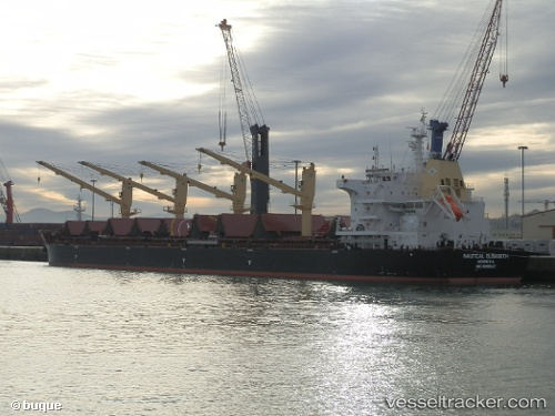
Vessel SANTOS EAGLE IMO: 9699347, MMSI: 538008641 Bulk Carrier
Live Vessel SANTOS EAGLE Analytics (details, animations, etc.)
Live AIS position: UTC. 18 nm W of Lushun New Pt), updated 2025-10-17 17:32:38 UTC.Find the position of the vessel SANTOS EAGLE on the map. The latter are known coordinates and path.
marine traffic ship tracker show on live map
The current position of vessel SANTOS EAGLE is 38.64298 lat / 120.79591 lng. Updated: 2025-10-17 17:32:38 UTCCurrently sailing under the flag of Marshall Islands
SANTOS EAGLE built in 2015 year
Deadweight:
63537 tDetails:
Last coordinates of the vessel:
2025-10-17 17:32:38 UTC, 38.64298, 120.79591, course: 297, speed: 3.9